Huntingdale maps the next chapter of its course
How a Melbourne Sandbelt club is building a living record of course improvements, vegetation management and seasonal discoveries following its major redevelopment.
Huntingdale Golf Club has entered a significant new chapter.
Following a major redevelopment led by OCM Golf, the Melbourne Sandbelt course has been reshaped to bring greater width, strategy and visual connection back to the property. Bold green complexes, renewed bunkering and more open playing corridors have transformed the golfing experience, while creating a new foundation for how the course will be managed in the years ahead.
As the focus moves from construction to the ongoing care and development of the course, retaining knowledge about what is happening across the property becomes increasingly important.
Huntingdale has now introduced CourseTrackR to help its team build that record.
Led by Vegetation Manager Kim Adair, the club’s vegetation team has mapped and established around eighty distinct vegetation areas across the course. Each area now has its own location-based record where the team can document site history, projects, completed works, time invested, photos and ongoing management activity.
Rather than information being dispersed across spreadsheets, notebooks, folders or individual staff knowledge, it can be connected directly to the part of the course where the activity occurred.
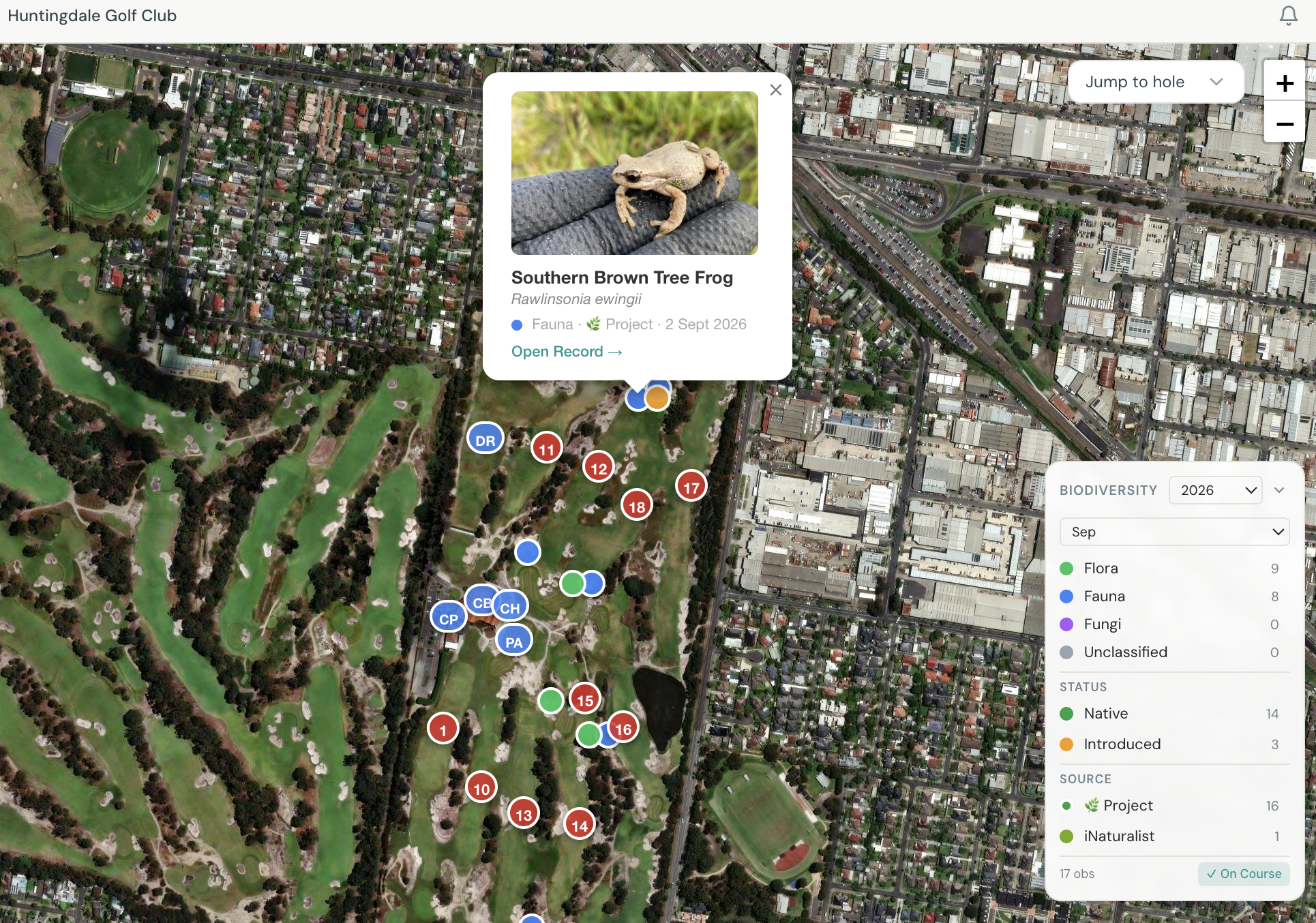
CourseTrackR also brings relevant biodiversity observations from iNaturalist into the club’s course record. This combines sightings recorded by Huntingdale’s team with observations contributed through the wider citizen-science community, providing a more complete picture of the plants and wildlife found across the property.
Connecting course work to place
Golf course management is inherently spatial. Planting, weed control, habitat improvement, tree works and ongoing maintenance are undertaken in specific areas, often over several seasons and by different members of the team.
CourseTrackR gives Huntingdale a way to retain the detail behind that work.
A mapped project area can show what was originally planned, what has since been completed and how the site is changing. Works, time, photographs and observations can be added to create a practical timeline that the team can return to without needing to reconstruct the history from memory.
That becomes particularly valuable at a course undergoing substantial change. The redevelopment has established the broader design direction, but the way individual areas mature and are managed will continue to influence how Huntingdale looks, plays and functions.
The records being created today can help inform future decisions about planting, regeneration, views and sightlines, transitions between maintained turf and native vegetation, and the presentation of areas beyond the immediate playing surfaces.
They also make handovers easier. If responsibilities change or new staff and volunteers become involved, the reasoning and work behind an area do not leave with the person who previously managed it.
From redevelopment to long-term management
A major course redevelopment does not finish when the construction team leaves.
Newly shaped areas need to establish. Planting develops over time. Weed pressure, seasonal conditions and maintenance requirements change. Some areas perform as intended, while others require further work or a different approach.
By mapping these areas and building a history around them, Huntingdale can follow that process over the longer term.
This gives the team a way to connect the design intent of the redeveloped course with the everyday work required to support it. It can help answer practical questions about what has been done, why it was done and what should happen next.
Instead of a project being considered complete once the initial work is finished, the club can continue documenting how the area establishes and responds to management.
Over time, that creates a useful feedback loop between planning, work on the ground and future decision-making.
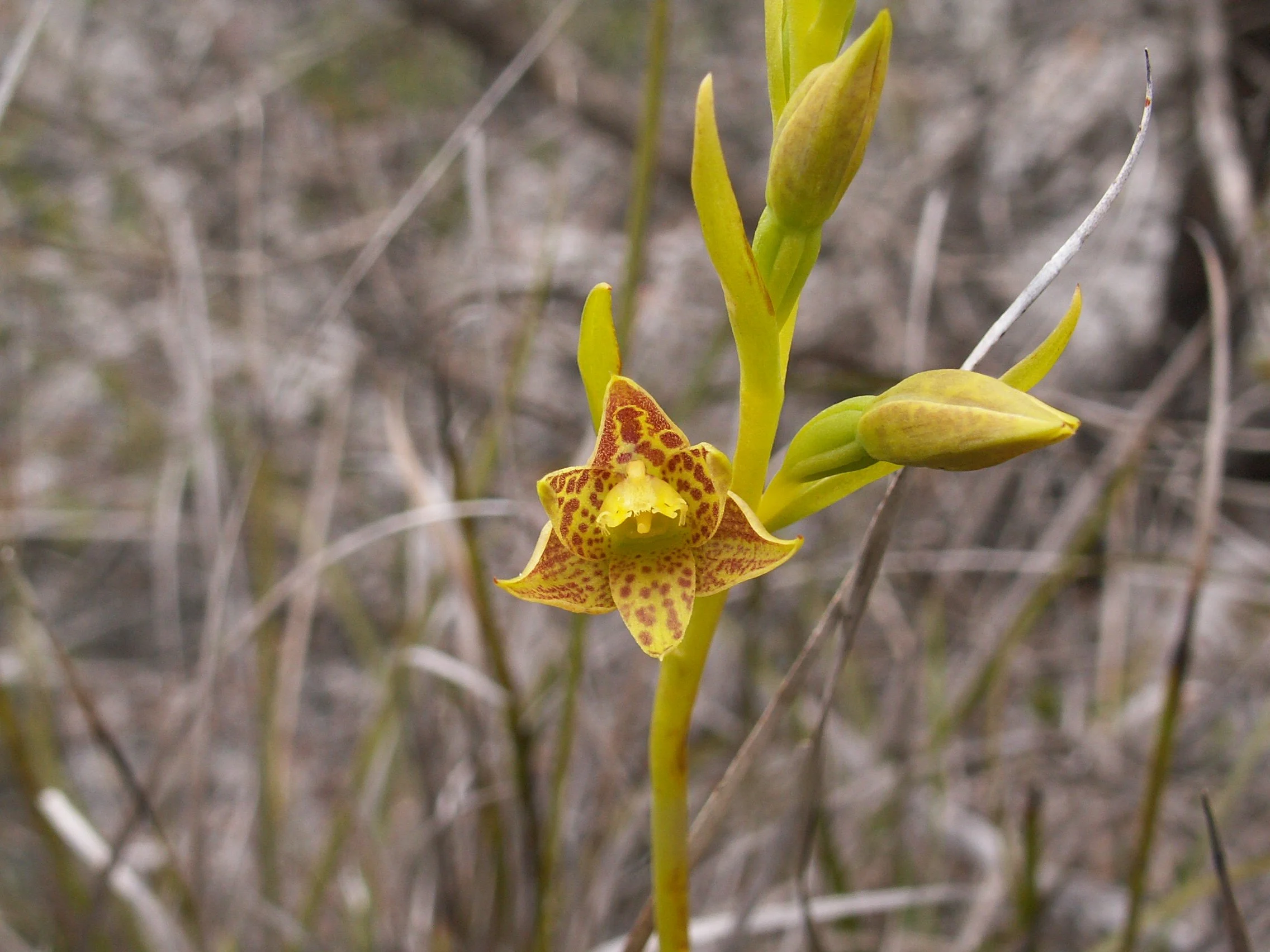
Australian Sun Orchid - Thelymitra benthamiana
Capturing a Sandbelt course through the seasons
Huntingdale is also building a valuable picture of how its vegetation changes through the year—not only through records entered by its own team, but through citizen-science observations available through iNaturalist.
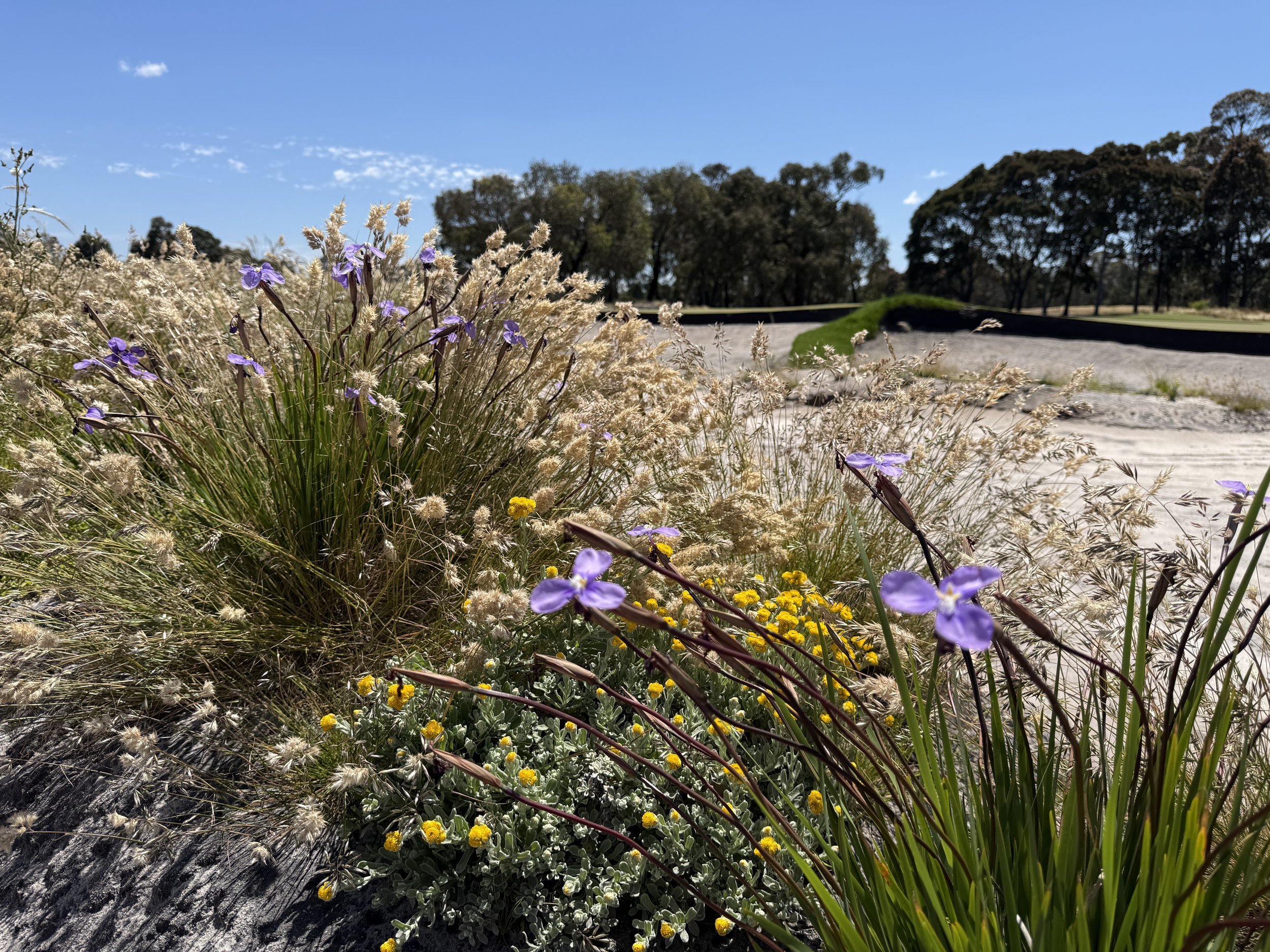
Between July and September 2026, close to eighty native plant observations representing more than seventy species were recorded across the property. Together, they provide a snapshot of a Sandbelt landscape moving from winter into spring.
Common Heath and Common Everlasting contribute seasonal colour, while Showy, Grey and Smooth Parrot-peas reflect the diversity found within the course’s lower-growing vegetation. Bearded-heath and Guinea-flowers add some of the finer textures that can be easily overlooked during the course of a working day.
Among the standout observations (and are rare sightings), were two groups of native orchids. Greenhoods were recorded at the beginning of July, followed by Sun Orchids in late July and early August.
These small plants can be difficult to see and may only be visible for a limited period. Bringing their locations into the same platform as the club’s mapped work gives the course team useful context when planning activity in those areas. It also establishes a seasonal reference that can be revisited and strengthened over future years.
Wildlife across the course
Birds form an important part of Huntingdale’s emerging course record. Observations contributed by the club and through iNaturalist can help show which species are present, where they have been seen and how their use of the property changes over time.
Bird records such as Yellow-Tailed Black-Cockatoos, Tawny Frog Mouths, Grey Butcherbirds, Purple Swamphens and Australasian Wood-Ducks that were seen on course in the last month or so, can also provide useful context for course management. Repeated sightings may indicate where birds are feeding, sheltering or moving across the property, while seasonal observations can help the team understand how different parts of the course are being used throughout the year.
The fauna record extends well beyond birds.
Southern Brown Tree Frogs and even Common Yabbies were recorded during the same period, together with insects, spiders and other invertebrates. These smaller and less conspicuous animals can be easy to overlook, but they remain part of the ecological activity taking place around the course.
Bringing these records together helps show that the course is not made up of isolated plant and animal sightings. It is a connected landscape of vegetation, water, soil, habitat and managed playing surfaces.
When wildlife observations are linked to the same mapped areas where planting, weed control and maintenance are being recorded, the club can begin to see how those different elements overlap.
Retaining the knowledge behind the course
For a busy course team, the value lies in capturing information once and being able to use it in several ways.
The same records that help staff understand an individual area can contribute to project reviews, future planning, staff handovers, committee updates and communication with members.
Instead of reporting only that work has taken place, Huntingdale can show where it occurred, what was involved and how the area has developed.
Over time, the club is building a baseline it can return to:
What was growing or observed in a particular area?
What work was completed and when?
How much time has the team invested?
What changed following that work?
Which plants and animals have since been recorded?
What ongoing management is required?
What should happen next?
This turns everyday activity into an increasingly valuable course record.
It can also help the club communicate a more complete story about the work happening beyond the playing surfaces. Members and committees can see not only the finished result, but the planning, care and ongoing management behind it.
For Huntingdale, CourseTrackR is becoming more than a record of species or individual projects. It is helping the club retain the knowledge behind the ongoing management and development of its course.
Following one of the most important redevelopments in Huntingdale’s history, that record will help connect the intent of the new design with the practical work required to care for it, season after season.
The result is a clearer picture of the whole course: how it is being managed, how its different areas are developing and how its distinctive Sandbelt landscape continues to evolve.